Welcome to æt wīcum Heritage.
We provide archaeological and heritage services for commercial and research purposes. We combine traditional archaeological techniques—such as field excavation and illustration—with sophisticated modern technologies like UAS (drone) based survey, GIS analysis and mapping, to understand, record, and protect the archaeological resource. We work with developers, researchers, and communities to make archaeology accessible and relatable, and to ensure cost-effective solutions.
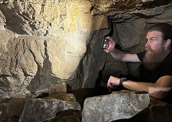
Scott is an experienced professional archaeologist, having worked for over fifteen years across a variety of commercial and research projects—from his early beginnings as an Archaeological Officer to his later career as a Senior Archaeologist and Heritage Consultant, and from there on to becoming a professional UAS (drone) pilot and surveyor.
Scott has worked on a diverse range of projects from single person watching briefs through to managing long duration, large open area excavations with teams of archaeologists. He has provided heritage consultancy for planning and development.
Scott was awarded his PhD by Cardiff University without changes. The research focus was directed towards the compilation of a complex GIS and 3D representation of the ancient necropolis at Saqqara, Egypt, to understand the construction and use of the ceremonial landscape during the Late and Ptolemaic periods.
Scott is an experienced user of QGIS, Adobe Photoshop, Illustrator, and InDesign, along with AutoCAD Map 3D, Infraworks 360, and ESRI ArcGIS. He is also skilled in GPS and total station field surveys, and is an A2 CofC and GVC qualified remote pilot with a wide range of experience in UAS surveys.
æt wīcum Heritage offers a range of services tailored towards development, research, and community projects. We utilize cutting-edge technology to reveal and record historical landscapes and buildings, ensuring accurate documentation, assessment, and analysis.
Our expert team provides heritage-led development solutions through precise data collection, spatial analysis, and planning advice, empowering you to enhance projects effectively. We provide geospatial services for university-led research projects and enable public engagement through local community outreach.
Engage with us to safeguard cultural legacies, navigate the complexities of heritage preservation, and make informed decisions based on our meticulous assessments. Discover how our innovative solutions can transform your approach to heritage management and preservation today.
GIS assessment and analysis
UAS (drone) geospatial surveys
Illustration (traditional and digital)
Written Schemes of Investigation (WSI)
Desk Based Assessments (DBA)
Heritage Impact Assessments (HIA)
Historic Building Recording (HBR)
æt wīcum Heritage is part of a group of small independent heritage and archaeological providers who collaborate to deliver a wide range of services within the heritage sector. Our strength is in our wide-ranging experience and expertise which allows us to provide comprehensive, professional, and focused advice, service, and value to developers, architects, local authorities, government institutions, and local community groups.
Please contact us via email or phone.